
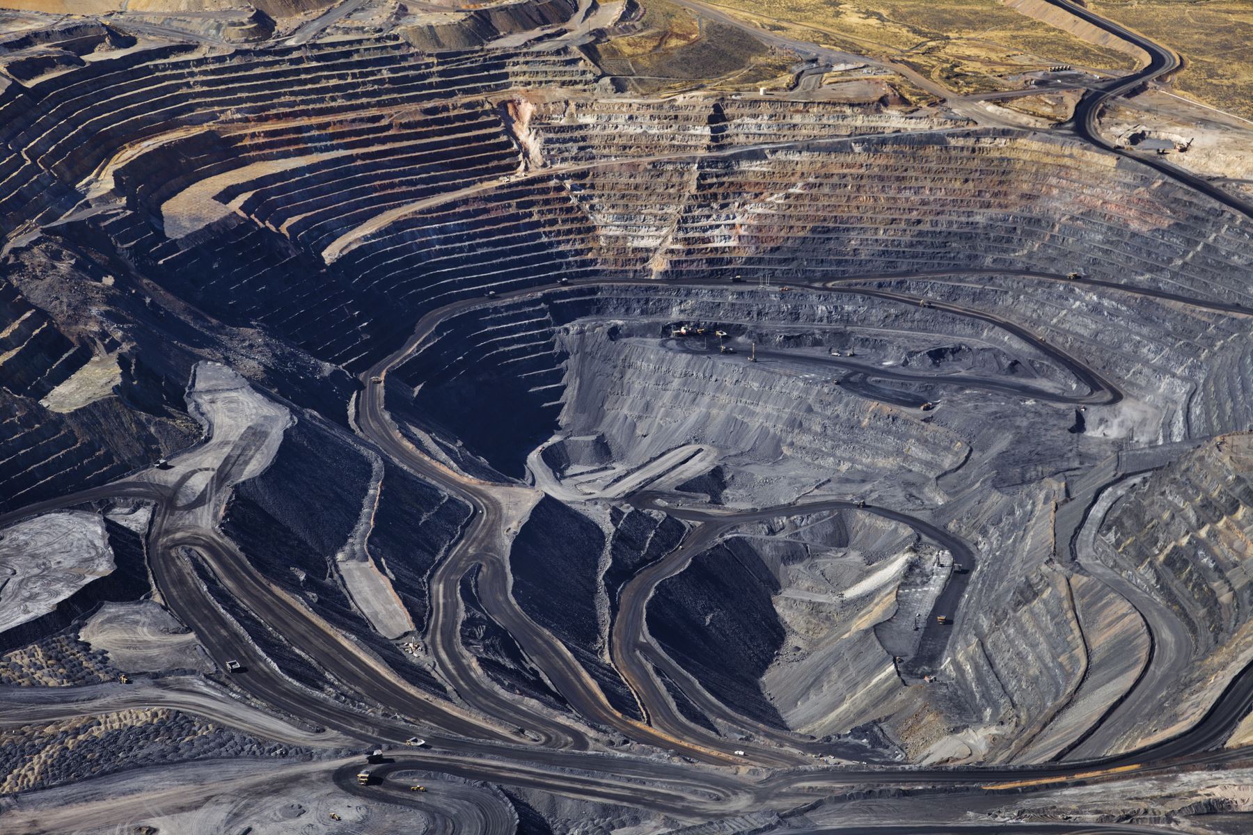
GeoStudio 2D
Starting fromUSD $2,720.00 (excl. tax)
12 months named license
Only 12 month named licences are available to purchase online. For shared and enterprise licences, please contact us.
Named license - allows unlimited use of the software for a single dedicated user during the subscription period.
Shared license - allows any number of users to access the software over the subscription period, limited to one user per seat at any given time.
GeoStudio 2D is an integrated software suite for modelling slope stability, groundwater flow, ground deformation, and more in soil and rock.
- Learn more
-
Buy now

Go to Virtuosity
Seequent products can be purchased securely through Virtuosity, Bentley's e-store. Seequent is the Bentley subsurface company.
Prices shown on Virtuosity will be displayed in your local currency excluding tax.

GeoStudio 3D
Starting fromUSD $6,900.00 (excl. tax)
12 months named license
Only 12 month named licences are available to purchase online. For shared and enterprise licences, please contact us.
Named license - allows unlimited use of the software for a single dedicated user during the subscription period.
Shared license - allows any number of users to access the software over the subscription period, limited to one user per seat at any given time.
GeoStudio 3D is an award-winning integrated software suite for modelling 3D slope stability and groundwater flow in soil and rock.
- Learn more
-
Buy now
Go to Virtuosity
Seequent products can be purchased securely through Virtuosity, Bentley's e-store. Seequent is the Bentley subsurface company.
Prices shown on Virtuosity will be displayed in your local currency excluding tax.

GeoStudio Flow
Starting fromUSD $4,085.00 (excl. tax)
12 months named license
Only 12 month named licences are available to purchase online. For shared and enterprise licences, please contact us.
Named license - allows unlimited use of the software for a single dedicated user during the subscription period.
Shared license - allows any number of users to access the software over the subscription period, limited to one user per seat at any given time.
GeoStudio Flow is a multi-physics finite element software for modelling environmental protection, groundwater flow, climate, and ground freezing problems.
- Learn more
-
Buy now
Go to Virtuosity
Seequent products can be purchased securely through Virtuosity, Bentley's e-store. Seequent is the Bentley subsurface company.
Prices shown on Virtuosity will be displayed in your local currency excluding tax.

PLAXIS 2D
Starting fromUSD $3,681.00 (excl. tax)
12 months named license
Only 12 month named licences are available to purchase online. For shared and enterprise licences, please contact us.
Named license - allows unlimited use of the software for a single dedicated user during the subscription period.
Shared license - allows any number of users to access the software over the subscription period, limited to one user per seat at any given time.
PLAXIS 2D is the industry standard for geotechnical 2D finite element analysis of deformation and stability in soil and rock - powerful, trusted, awarded and user-friendly.
- Learn more
-
Buy now
Go to Virtuosity
Seequent products can be purchased securely through Virtuosity, Bentley's e-store. Seequent is the Bentley subsurface company.
Prices shown on Virtuosity will be displayed in your local currency excluding tax.
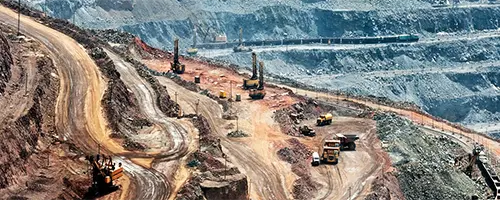
PLAXIS 3D
Starting fromUSD $10,339.00 (excl. tax)
12 months named license
Only 12 month named licences are available to purchase online. For shared and enterprise licences, please contact us.
Named license - allows unlimited use of the software for a single dedicated user during the subscription period.
Shared license - allows any number of users to access the software over the subscription period, limited to one user per seat at any given time.
PLAXIS 3D is the industry standard for geotechnical 3D finite element analysis of deformation and stability in soil and rock - powerful, trusted, awarded and user-friendly.
- Learn more
-
Buy now
Go to Virtuosity
Seequent products can be purchased securely through Virtuosity, Bentley's e-store. Seequent is the Bentley subsurface company.
Prices shown on Virtuosity will be displayed in your local currency excluding tax.

PLAXIS Monopile Designer
PLAXIS Monopile Designer offers a design method to reduce steel quantity in monopile foundations and costs of wind farming.
- Learn more
-
Go to Virtuosity
Seequent products can be purchased securely through Virtuosity, Bentley's e-store. Seequent is the Bentley subsurface company.
Prices shown on Virtuosity will be displayed in your local currency excluding tax.
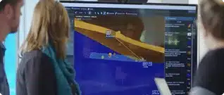
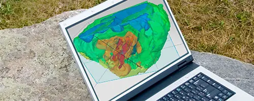
Leapfrog Geo
Integrate, communicate, and interpret geoscience data with rapid 3D modelling.
- Learn more
-
Go to Virtuosity
Seequent products can be purchased securely through Virtuosity, Bentley's e-store. Seequent is the Bentley subsurface company.
Prices shown on Virtuosity will be displayed in your local currency excluding tax.
Leapfrog Energy
Make clear and confident decisions for energy development and operations.
- Learn more
-
Go to Virtuosity
Seequent products can be purchased securely through Virtuosity, Bentley's e-store. Seequent is the Bentley subsurface company.
Prices shown on Virtuosity will be displayed in your local currency excluding tax.

Leapfrog Works
Visualise and communicate ground conditions with fast, dynamic 3D geological modelling for civil & environmental projects.
- Learn more
-
Go to Virtuosity
Seequent products can be purchased securely through Virtuosity, Bentley's e-store. Seequent is the Bentley subsurface company.
Prices shown on Virtuosity will be displayed in your local currency excluding tax.
Leapfrog Edge
Fully integrate resource estimation into your 3D geoscience models.
- Learn more
-
Go to Virtuosity
Seequent products can be purchased securely through Virtuosity, Bentley's e-store. Seequent is the Bentley subsurface company.
Prices shown on Virtuosity will be displayed in your local currency excluding tax.
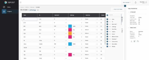
MX Deposit
Collect, manage, share, and access your drillhole and sample data in the Cloud.
- Learn more
-
Go to Virtuosity
Seequent products can be purchased securely through Virtuosity, Bentley's e-store. Seequent is the Bentley subsurface company.
Prices shown on Virtuosity will be displayed in your local currency excluding tax.
Seequent Central
Cloud-based Seequent Central offers shared 3D visualisation, team collaboration, and tracking of geological data within a single, auditable environment.
- Learn more
-
Go to Virtuosity
Seequent products can be purchased securely through Virtuosity, Bentley's e-store. Seequent is the Bentley subsurface company.
Prices shown on Virtuosity will be displayed in your local currency excluding tax.
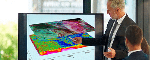
Oasis montaj
Visualise, analyse, and integrate all your geoscience data in interactive 2D and 3D models.
- Learn more
-
Go to Virtuosity
Seequent products can be purchased securely through Virtuosity, Bentley's e-store. Seequent is the Bentley subsurface company.
Prices shown on Virtuosity will be displayed in your local currency excluding tax.
Target
Process, QA/QC, visualize and interpret your surface and subsurface geoscience or exploration data.
- Learn more
-
Go to Virtuosity
Seequent products can be purchased securely through Virtuosity, Bentley's e-store. Seequent is the Bentley subsurface company.
Prices shown on Virtuosity will be displayed in your local currency excluding tax.
Target for ArcGIS Pro
Advance your understanding of drillhole and subsurface data within Esri ArcGIS Pro.
- Learn more
-
Go to Virtuosity
Seequent products can be purchased securely through Virtuosity, Bentley's e-store. Seequent is the Bentley subsurface company.
Prices shown on Virtuosity will be displayed in your local currency excluding tax.
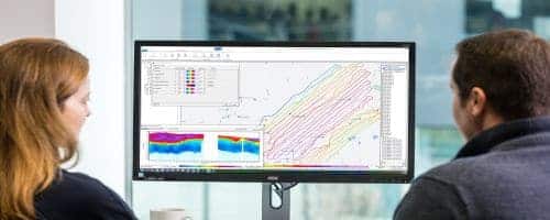
AGS Workbench
Tailor and refine every step of your EM, ERT, or IP workflow from raw data to final geophysical models, and present results confidently.
- Learn more
-
Go to Virtuosity
Seequent products can be purchased securely through Virtuosity, Bentley's e-store. Seequent is the Bentley subsurface company.
Prices shown on Virtuosity will be displayed in your local currency excluding tax.
Volsung
The standard for geothermal reservoir simulation.
- Learn more
-
Go to Virtuosity
Seequent products can be purchased securely through Virtuosity, Bentley's e-store. Seequent is the Bentley subsurface company.
Prices shown on Virtuosity will be displayed in your local currency excluding tax.
SPIA
TEM and DC/IP VES data processing and inversion.
- Learn more
-
Go to Virtuosity
Seequent products can be purchased securely through Virtuosity, Bentley's e-store. Seequent is the Bentley subsurface company.
Prices shown on Virtuosity will be displayed in your local currency excluding tax.
OpenGround
OpenGround is a secure, cloud-based geotechnical information management platform for collecting, reporting, managing, visualising, analysing, and accessing geotechnical data.
- Learn more
-
Go to Virtuosity
Seequent products can be purchased securely through Virtuosity, Bentley's e-store. Seequent is the Bentley subsurface company.
Prices shown on Virtuosity will be displayed in your local currency excluding tax.
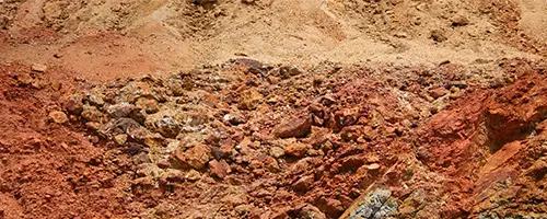
Imago
Imago enables validation of data insights and decisions by capturing, managing, and sharing high-quality geoscientific images in the cloud.
- Learn more
-
Go to Virtuosity
Seequent products can be purchased securely through Virtuosity, Bentley's e-store. Seequent is the Bentley subsurface company.
Prices shown on Virtuosity will be displayed in your local currency excluding tax.
Hydro Structural Modelling – HSM
Use data to better predict the impact of aquifer structural uncertainty on water flow.
- Learn more
-
Go to Virtuosity
Seequent products can be purchased securely through Virtuosity, Bentley's e-store. Seequent is the Bentley subsurface company.
Prices shown on Virtuosity will be displayed in your local currency excluding tax.
Res2DInv and Res3DInv
See results fast – easily process and invert your Resistivity and Induced Polarization data in two clicks.
- Learn more
-
Go to Virtuosity
Seequent products can be purchased securely through Virtuosity, Bentley's e-store. Seequent is the Bentley subsurface company.
Prices shown on Virtuosity will be displayed in your local currency excluding tax.
Unexploded Ordnance (UXO) Detection
The trusted industry standard for assessment, analysis, and classification of UXO targets.
- Learn more
-
Go to Virtuosity
Seequent products can be purchased securely through Virtuosity, Bentley's e-store. Seequent is the Bentley subsurface company.
Prices shown on Virtuosity will be displayed in your local currency excluding tax.
GM-SYS
Integrate seismic, well, and geology data with observed gravity and magnetics.
- Learn more
-
Go to Virtuosity
Seequent products can be purchased securely through Virtuosity, Bentley's e-store. Seequent is the Bentley subsurface company.
Prices shown on Virtuosity will be displayed in your local currency excluding tax.
DAP Data Management
Ensure your geoscience data is of the highest quality – in one single, accessible source.
- Learn more
-
Go to Virtuosity
Seequent products can be purchased securely through Virtuosity, Bentley's e-store. Seequent is the Bentley subsurface company.
Prices shown on Virtuosity will be displayed in your local currency excluding tax.
Geosoft Viewer
Free software to easily view and share your geoscience data visualisations.
- Learn more
-
Go to Virtuosity
Seequent products can be purchased securely through Virtuosity, Bentley's e-store. Seequent is the Bentley subsurface company.
Prices shown on Virtuosity will be displayed in your local currency excluding tax.
Not sure what solution is
Right for your needs?
Contact us
