To check if your computer meets minimum specs, and find out our recommended options, read our system requirements.
Viewers


Applications
Applications require an active subscription and Seequent ID to be used.
Leapfrog


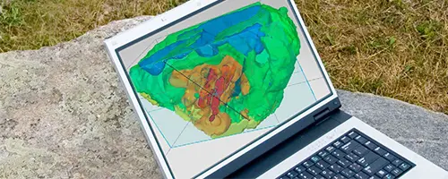
Leapfrog Edge
Fully integrate resource estimation into your 3D geoscience models.
Geosoft


GEOSLOPE

GeoStudio
Model slope stability, ground deformation, and heat and mass transfer in soil and rock.
AGS

Res2DInv
Easily process and invert your 2D resistivity and induced polarization data for quick and accurate insights.

Res3DInv
Easily process and invert your 3D resistivity and induced polarization data for quick and accurate insights.

Workbench
Tailor and refine every step of your EM, ERT, or IP workflow from raw data to final geophysical models, and present results confidently.

Data Management


Geothermal Simulation

Plug-ins & Utilities
A troubleshooting tool that gathers information about your computer and any GEOSLOPE products installed on it.
All you need to run a FlexNet™ Publisher License Server Manager (“lmadmin”) for use with network (floating) licenses that will work with any version of GeoStudio.
Plug-in to view and use Geosoft grids, shaded grids, and map files in MapInfo.
For use with all GeoStudio USB hardware keys on all versions of Windows.
Developer Tools
The GeoStudio Add-In Developer’s Kit (SDK) includes instructions, templates and sample code to let you write your own Add-Ins.
Developer resources to extend Geosoft platforms and use the GX API in your own applications.