Create your VOXI project directly within Oasis montaj – the industry-standard platform for geophysics and then harness the power of on-demand Cloud computing.
Lightning-fast, intuitive geophysical inversion with VOXI
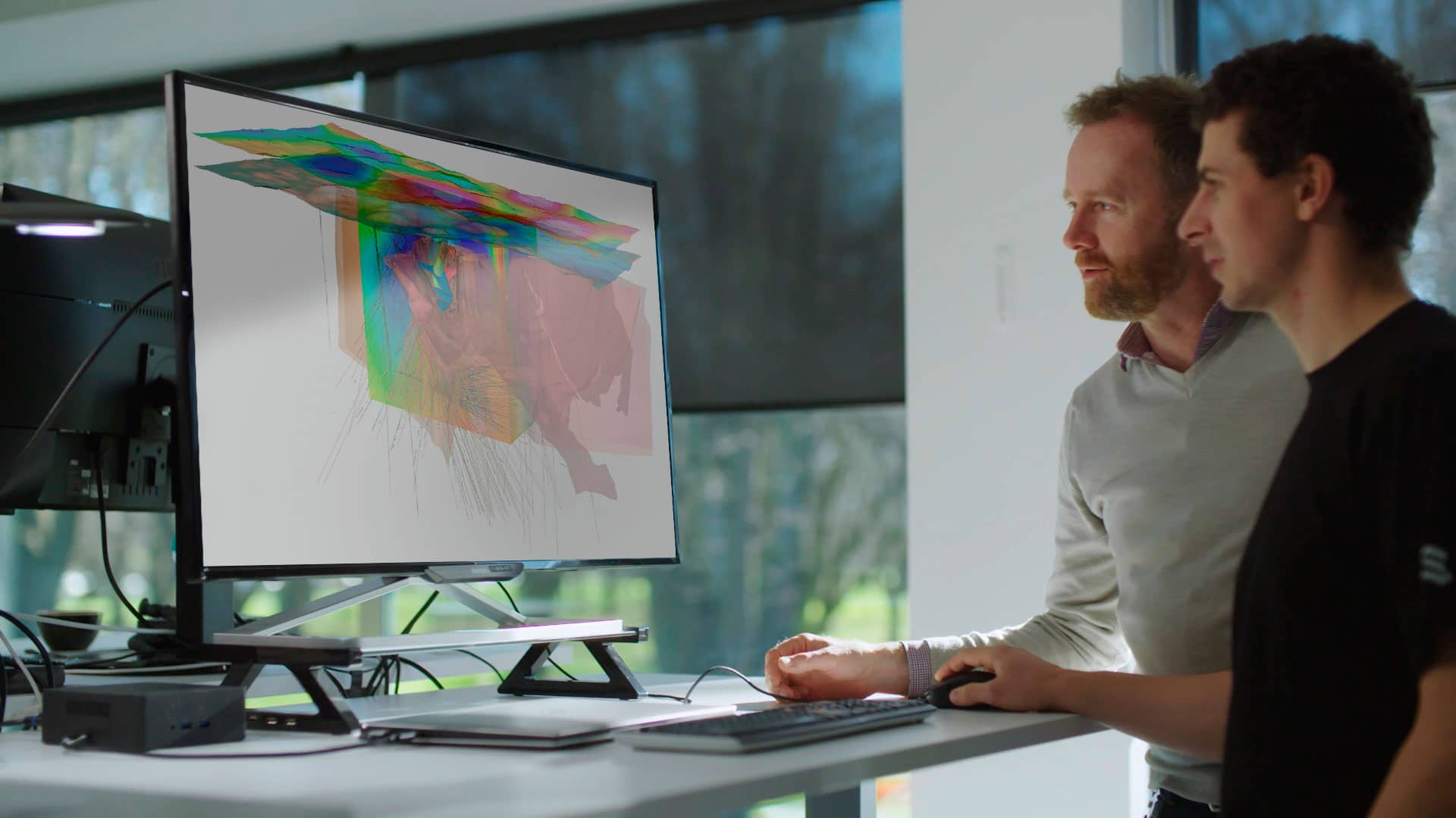
Visualise the deep subsurface with Cloud-powered speed and responsiveness
Schedule a demoTalk to usFree up your computer – run inversions in the Cloud
Generate inversions in minutes, not days
Faster, Cloud-based geophysical inversion modelling gives you more time for interpretation and allows you to work on other tasks while your model processes remotely.
Cloud computing is available on-demand with no overhead cost or setup – simply click “Run.” Ensure project data is private with a secure and encrypted connection to Microsoft Azure.

Rapidly iterate models
As new data and insights become available, quickly build new model iterations using data and model integration tools in VOXI. Apply new constraints and then run another inversion to test different modelling hypotheses.
Add multidisciplinary insight
VOXI is directly integrated within Oasis montaj, providing a new way to interact and collaborate on geophysical models.
Inversion models can be constrained and efficiently integrated with exploration data from other teams, including borehole data, geological models, and geochemical data.
VOXI Earth Modelling requires Oasis montaj.
VOXI Stories

Effective approaches to potential field modelling in hydrocarbon exploration
In a challenging economic environment, potential field modelling can prove extremely useful to hydrocarbons exploration.…
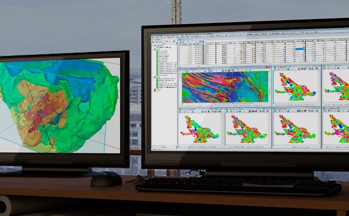
Streamline model creation, data integration, and interpretation
Your entire exploration team can collaborate on geophysical models, adding 3D models and real-world observations from other software packages, including Leapfrog Geo.
Incorporate their insights into VOXI inversions or forward calculations with easy-to-use tools.

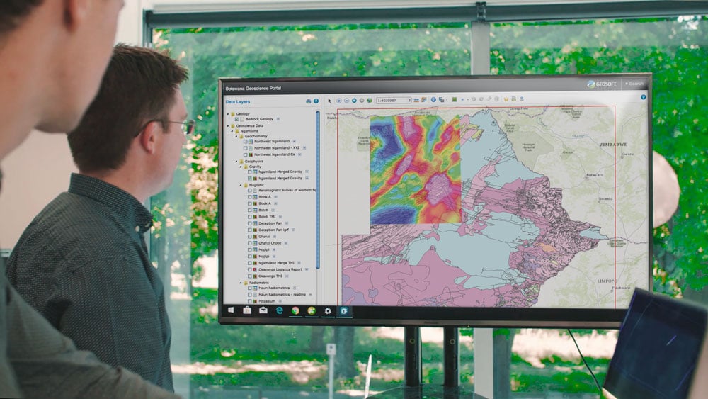
Import and organise project data
Import and work with more than 50 supported data types and formats. Efficiently store large geoscientific datasets in high-performance databases to improve data access.

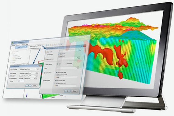
Build and constrain models
Use the Model Builder to incorporate supplementary geological, geophysical, and geochemical information. Automatically apply these models as constraints to the inversion.
The defaults are auto-populated and the math is applied automatically, making creation of constraints easier and freeing up your time for interpretation.

Sharpen contacts
Iterative Reweighting Inversion (IRI) takes a smooth earth model and uses it as a reweighting constraint when running a new inversion of the same data.
Model sharper contacts in the inversion result to create more refined targets. IRI is automated, saving processing time so that your results are available faster.

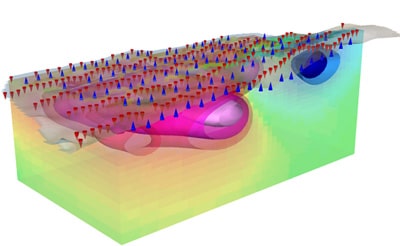
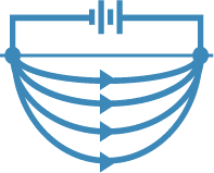
Model conventional gravity and magnetic field data
Generate forward and inverse models of conventional gravity and magnetic field data. Create density and susceptibility models quickly and easily. Constrain results by incorporating information from geological, geochemical, or geophysical observations.
Model gravity gradiometry data
Run inversion and forward modelling on gravity gradiometry data. Yield a detailed 3D model of rock density to be used to interpret and to target regions for potential oil, gas, and mineral deposits.
Generic vertical gravity gradient data is supported as well as direct import of two common data types: Falcon AGG data and Bell Geoscience/ARKeX LM FTG data.

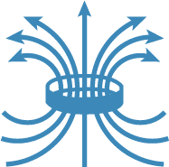
Model the 3D magnetisation vector
Traditional susceptibility inversions assume that subsurface magnetisation is in the direction of Earth’s magnetic field. More often than not, this assumption is false and can yield inaccurate inversion results.
Magnetisation Vector Inversion (MVI) is a method that solves for both magnitude and direction, which has been shown to coincide more closely with known geology than traditional susceptibility models.
Model frequency domain EM data
Invert frequency domain horizontal coplanar configuration electromagnetic (EM) data to produce a voxel conductivity model. Then, integrate this conductivity model with your gravity and magnetic inversions into a geophysical or geological interpretation in Oasis montaj.
The FDEM inversion is based on 1D inversions interpolated along and between lines, suitable for airborne frequency domain systems such as Dighem or Resolve.
Model time domain EM data
Model subsurface conductivity using the VOXI Time Domain Electromagnetic (TDEM) inversion method which supports a variety of transmitter configurations, such as the SkyTEM, Geotech VTEM, and NRG Xcite airborne EM systems.
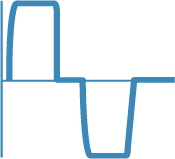
Model IP and Resistivity data
Yield a detailed model of conductivity and chargeability through inversion and forward modelling of conventional IP and resistivity data as well as spectral IP data.
Create full 3D or along-profile models from any electrode configuration. Use the resulting models to interpret and target regions for mineral and environmental applications.
Visualise the deep subsurface with Cloud-powered speed and responsiveness
Enquire nowHow to get started with VOXI?
VOXI requires Oasis montaj.
Depending on the size of your model and the types of data you’d like to invert, you can select a VOXI subscription plan that suits your projects.
Try VOXI for free
Gravity field modelling for density and magnetic field modelling for susceptibility are FREE for models less than 50×50 cells in area. Oasis montaj is required to run VOXI.
VOXI subscriptions
Use VOXI to run geophysical inversions on demand with a pay-as-you-go plan or create unlimited models with a monthly, or annual subscription. Corporate subscriptions are also available for larger teams working on multiple projects.
For current Oasis montaj users, view complete VOXI subscription options here:
Useful Information
System Requirements
We recommend you use Windows 10, with a reasonably fast processor, mid range graphics and 16-32GB of system memory.
Supported Data/Formats
Supported kinds of data and formats that you can use with Voxi.