Bring all your insights together in Oasis montaj with specialised extensions for magnetic and gravity, resistivity, geological, radiometric, and geochemistry data.
Get more from data with
Oasis montaj Extensions
Transform geophysics, geology, GIS, and geochemistry data – all in one place
Talk to an expertEnhance the processing power of Oasis montaj

Ensure high quality data
Automatic and manual quality control tools identify problematic data and correct it. Always know that all data is properly geo-located regardless of its coordinate system.

Translate data into value
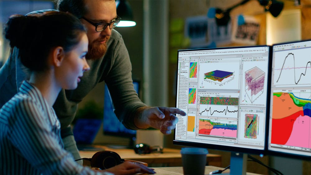
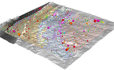
Create and share interactive 2D and 3D visualisations that make data meaningful. Work with data outside of your domain with guided operations and user-friendly workflows.

Free your time
Digitise and import data from any source, position it, and integrate it into your project instantly.
Define filters, modify parameters, and apply any number of filters together in one single operation. Overlay complementary data to build your interpretation and run rapid geophysical inversions in the Cloud.
Oasis montaj special extensions
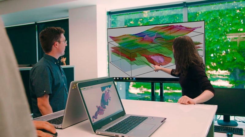
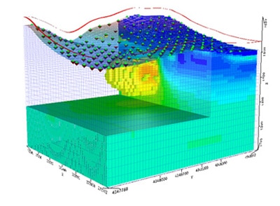
Rapid 3D geophysical inversion
Invert your collected geophysics with powerful Cloud-powered speed and a user-friendly interface to enhance subsurface visualisation. Take the processing load off of your computer so you can work on other tasks.
More extension information:
Rapid 3D geophysical inversion
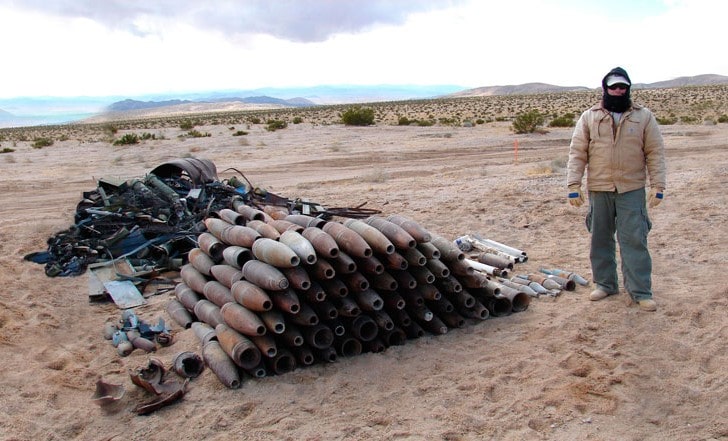
UXO detection onshore and offshore
Use the industry standard for survey planning, data QA/QC, analysis, and target definition for land and marine unexploded ordnance.
Developed in partnership with leading government agencies.
More extension information:
UXO Land
UX Analyze
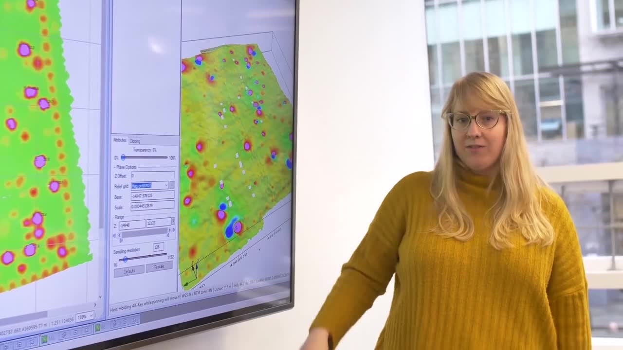
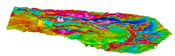
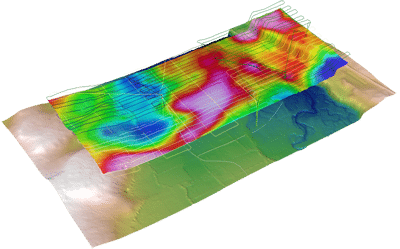
Gravity and magnetics in 2D and 3D
Validate your geological model using gravity and magnetics data. Build interactive, layered earth models to visualise the variation and irregularity of subsurface structures – and calculate the model’s gravity and magnetic responses.
More extension information:
GM-SYS Profile
GM-SYS 3D
Discover some of the exciting new developments made to Oasis montaj
“The variety of tools available for processing and interpreting our gravity and magnetic data, and ease of application, allows us to achieve project completion in a short period of time.”
Julio LyrioProduction Geophysicist, Petrobras
Ask us about extensions
Talk to an expertOasis montaj extensions help you work with:
Magnetic and gravity data
- Visualise, transform, and enhance your raw magnetic and gravity data into industry standard deliverables that inform real decisions.
- Rapidly process and enhance 2D gridded magnetic and gravity datasets using a wide range of geophysical and mathematical filters.
- Interactively apply 2D data transforms, including reduction of magnetic data to the magnetic pole or equator, derivatives, and upward/downward continuations.
- Test different filter parameters and view a real-time preview of how each filter enhances specific features, including 2D filters and matched filters for better depth slicing — before you apply it to your entire grid.
- Use depth to source calculation tools to estimate location of anomalies in 2D and 3D.
- Constrain and integrate your magnetic and gravity models with geology, GIS, and geochemistry data.
- Interpret, invert, and model potential field data for both sections and the full subsurface.
More extension information:
2D Filtering extension
Airborne quality control extension
CET Grid Analysis extension
CET Porphyry Detection extension
Compudrape extension
Geophysics extension
Gravity and terrain extension
Gravmag interpretation extension
Geophysics levelling extension
GridKnit extension
Isostatic Residual extension
Depth to Basement extension
PotentQ Extension
Predictive Targeting Extension
Conductivity and resistivity data
- Transform your measured data into high value interpretation deliverables. Perform resistivity depth transforms on your raw data and visualise it in 2D and 3D.
- Quickly create resistivity sections and pseudo sections from your Induced Polarisation (IP) or Electromagnetic (EM) data.
- Georeference, orient and integrate your resistivity data with your geophysical and geological interpretations. The right tools to flag poor quality measurements and confidently address problematic data.
- Calculate EM decay constant (Tau), and invert for Conductivity, and Chargeability on your EM or IP data.
- Model and run fast geophysical inversions on your EM or IP data using VOXI Earth Modelling.
Geological data
- Increase your understanding of surface and subsurface geology. Digitise maps and images, orient them, and integrate them quickly into 2D and 3D geological models.
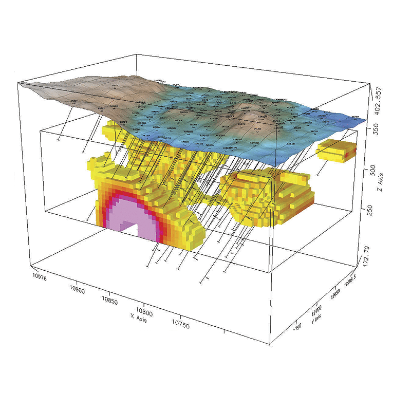
- Visualise, QA/QC, and interpret your surface and drill hole or borehole geophysics data. Easily and accurately produce presentation-quality drill hole plans, sections, strip logs, stacked sections, structural plots, and 3D visualisations.
- Process and analyse large volume drill hole data. Generate and manage exploration drilling projects.
- Import data directly from the most common online repositories. Produce high quality maps for interpretation and target definition.
More extension information:
CET Grid Analysis
CET Porphyry Detection
Compudrape
Drillhole plotting extension
Radiometrics and spectrometry data
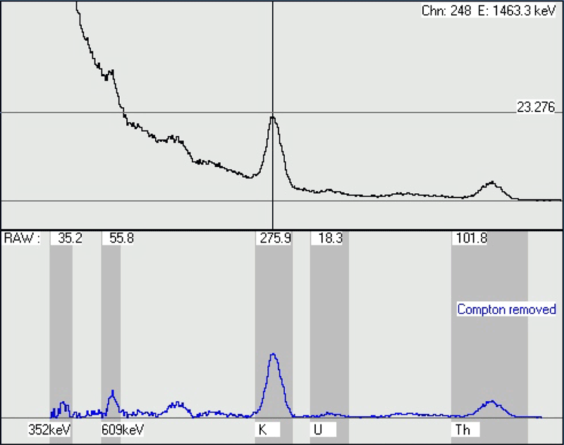
- Reduce radiometric data to concentrations for use in geological and geophysical mapping – without needing to be a domain expert.
- Process and QA/QC radiometric data within Oasis montaj. Perform industry standard data reductions to your dataset. Transform raw counts into equivalent ground concentrations, ratios, dose rate, and produce ternary maps.
- Reduce noise using a wide variety of full spectrum statistical techniques, including NASVD and MNF. Easily identify and remove often challenging Radon pollution from your data
- Process and visualise ground and airborne spectrometer survey data from acquisition, to processing and presentation.
Geochemistry data
- Integrate surficial maps, assay reports, and complex geochemical analyses with your geophysical, geology, and GIS data – all within Oasis montaj. Use guided, user-friendly workflows designed for non-specialists working with geochemistry data.
- Analyse multi-element geochemistry with principle component analysis, probability analysis, interactive summary statistics, histograms, tri-plots, and correlation plots.
- Perform essential tasks for due-diligence and reporting QA/QC tools to confirm the validity and quality of geochemical data, including assay, standards, and location data acquired in surveys.
- Simplify the quality control process with easy-to-use standard and duplicate handling capabilities.
Working with UAV data?
- Streamline your magnetic airborne UAV surveys with a complete workflow.
- Plan surveys: Subdivide the survey area based on drone range while remaining compliant with local Visual Line of Sight (VLOS) requirements.
- Import and process data: Easily import common drone magnetometer files using pre-built templates. Save time by batch importing all your sorties at once.
- Clean your data: Correct, level, and merge several adjacent UAV sortie datasets into one single dataset.