The challenge? Generally, less than 20% of stored geoscience data is actually good, useful data – then there’s the matter of finding it.
Better data, better decisions with DAP Data Management
Ensure your geoscience data is of the highest quality – in one single, accessible source
Get a demoTalk to usGood decisions come from good data
Garbage in = garbage out
Cleanse your data before it’s stored. Consolidate and catalog your geoscience data for fast search and retrieval.
DAP geoscience data experts ensure your data is high quality, meta-tagged for easy discovery, and organised for fast retrieval.

Share data
Avoid confusion with one source for all your files. Make sure the people that need data to make decisions can access it – and sort through it. Digitise, publish, and share historical, current, and future project data with your whole organisation.
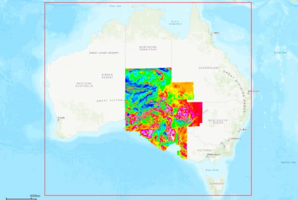
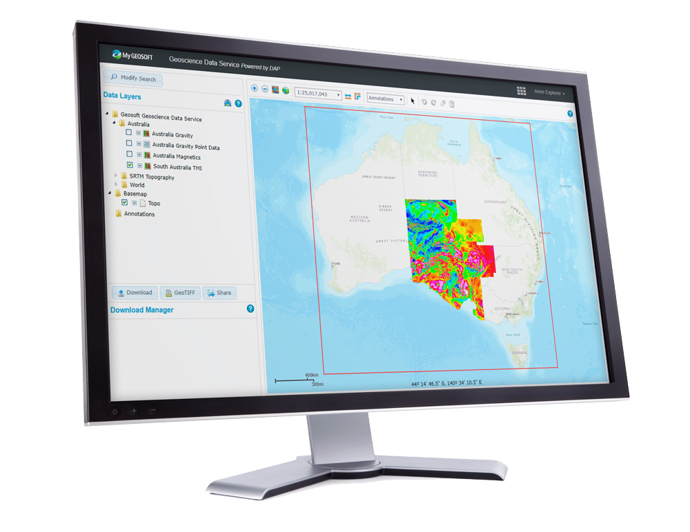
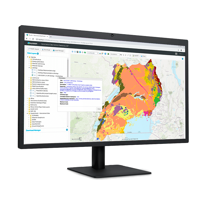
Host data onsite or remotely on a secure, accessible data portal. Visually search through location-specific data using an interactive map.
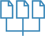
Integrate information
Retain knowledge, minimise risk, and use all available data to make better decisions. Catalog and share a range of file types, including very large geospatial grids, geophysics data, images, and vector data.
Directly import and export data from common geoscience databases and software, including acQuire, Esri, Target, Oasis montaj, and more. Access and integrate publicly available data to build on your insights.
“People used to spend a lot of time running around looking for stuff they couldn't find, but now they can find it right away because it's all coming from one place. That has improved our effectiveness. It's a one-stop shop.”
Peter Thurston
“Up to now, we’ve had all this uncatalogued data. To find it, you had to wade through folders and directory structures. With the new procedure, the client receives the data it requests and that same data is then entered into the online database, making it available for future reference.”
Mark ThorntonThe Geological Survey of Queensland
Spend time on decisions, not data management
Do you work with large data sets, multiple projects, multiple teams, or want to digitise data?
Our geoscience data experts have deep knowledge of filetypes, structure, and integrations with other software to help you clean and organise data without losing files.
DAP is designed specifically for geoscience data:
Efficient data discovery
Establish and manage a trusted, organised data foundation to reduce time, costs, and increase your discovery potential. Search for data based on an area-of-interest or metadata keywords.

Scale with your data
DAP offers scalable technology for cataloguing and managing hundreds of thousands of datasets, and enabling access by simultaneous users.
Integrate data repositories and GIS
Exchange data seamlessly with geoscience software and databases, including Oasis montaj, Target, Esri, MapInfo, and others.
Metadata management
Users can easily search through data using collected metadata keywords to improve the efficiency of finding and interpreting relevant data – and increase the use of your information assets.
Administration and security
DAP Administrator Web Portal provides a comprehensive toolset for data managers to administer DAP servers and manage user and dataset security settings via Seequent ID.
Generate reports on corporate data assets and how they are being used by your geoscientists to make decisions.
File types
Efficiently catalog and deliver a broad range of data file types, including very large geospatial grids, geophysical datasets, images, and vector data.
Ensure your geoscience data is of the highest quality - in one single, aceessible source.
Enquire nowTell us about your data
How DAP Data Management works:
- Work with our geoscience data experts to analyse the current state of your data within your organisation.
You’ll get a report assessing data quality issues and recommendations on how to remediate any data deficiencies. - We can assist you with remediating existing data, and help establish rules and best practices for future projects. We’ll also show you how to integrate DAP with the geoscience software and databases you use.
- Remote staff? On-site server? Need to display public data? We’ll help you select a server environment that meets your needs and set you up for success.

Make data sharing interactive
Create an online, interactive map to display all your location-based data. See what data is available where, and then access those files from your database.
Instantly source and overlay publicly available information alongside internal information, such as geoscience data and topography, and zoom into areas of interest.
Share your data with select people, like investors or teams, or with the public.