Advance your understanding of drillhole and subsurface data in the next generation Esri ArcGIS Pro environment.
Explore with confidence using Target
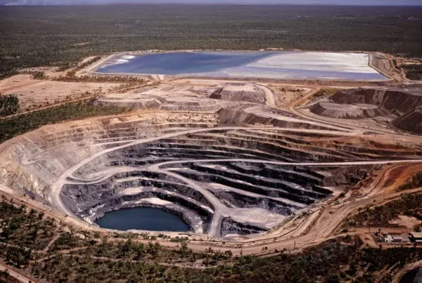
Visualise, quality control, and share drillhole and geoscience data – to find what’s hidden, faster.
Schedule a demoTalk to usWorking with GIS?

Make faster, more informed exploration decisions
Explore more effectively
Automate routine data processing tasks and streamline workflows to spend less time processing data and more time exploring. Easy-to-use interactive tools support every stage of your exploration projects, so you can:
- Import drilling and subsurface data from a wide variety of sources
- Perform quality control and calculate economic composites
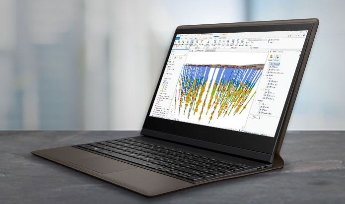
- Create plan maps and single or multiple sections with 3D visualisation and interpretation tools
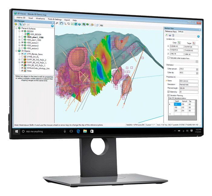
- Build 3D subsurface geological models, 3D voxels, or block models and isosurfaces with wireframing tools
- Plan drillholes in 2D and 3D

Bring all data together
Make confident decisions using all of your existing and ongoing geology, geophysics, geochemistry, and GIS data. Create integrated interpretations that improve prospecting and discovery results.
Import and organise more than 50 supported data formats including CAD, GIS, and mine planning and modelling. Connect your 3D model with the original data to validate your thinking. Build iterations rapidly and refine your 3D results as new data is collected.
Collaborate across disciplines
Effectively share and discuss your results with team members and knowledge experts. Work together to better manage project risk, costs, and timelines.
View all your drillhole data as maps, sections, and 3D views in a single integrated environment. Incorporate data from major mine planning and other exploration software formats. Share your results as 2D or 3D PDF files or by exporting them to a variety of file formats.

“Target is very intuitive and easy to learn, but the key is how well it integrates surface data and downhole drill data. With the wireframing features now incorporated, it’s also able to meet our 3D geology requirements.”
Jim RoyallExploration Manager
“Target allows us to do comprehensive compilations by tying in historical data with airborne and ground geophysics and our latest geochemical and drillhole data. It graphically communicates important information to both investors and geologists.”
Garrett AinsworthVice President of Exploration
Integrate your exploration data
Minimise risks, costs, and time with automated and manual tools for data QA/QC, modelling, and analysis.

Data import, organisation, and validation
User-friendly import wizards and efficient databases enable quick organisation of all types of drilling data. Work with more than 50 supported data formats. Validate, identify, and correct discrepancies with a full set of quality assurance and quality control tools.

Integrated mapping and analysis
Create integrated maps using geology, geophysics, geochemistry, GIS data, and satellite imagery to increase your subsurface understanding. Create grids, and add contours, geophysics, and remote sensing data to enhance your interpretations and guide drilling decisions.
Work seamlessly across exploration and GIS environments with built-in Esri integration.

Section mapping and interpretation
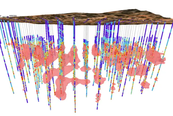
Visualise your subsurface data by creating sections, stacked sections, fence diagrams, and graphical borehole logs. Quickly create detailed sections for interpretation and geological modelling.
Incorporate surface data, slice voxels and 3D wireframes or meshes into sections to guide your interpretations. Share results and information more efficiently via visually rich e-maps, 3D PDFs, and Map Snapshots to mark areas of interest.

Geological modelling
Build 3D subsurface geological models from digitised interpretations with Target’s easy-to-use wireframing interface. Collaborate on 3D modelling projects by sharing interpretations and wireframing results.
Create 3D voxel block models and isosurfaces from your drillhole data. Calculate volume and grade estimates based on geological models.

Drillhole planning and reporting
Create professional presentations for daily or seasonal drillhole planning and project management. Plan new drillholes within an existing project – in 2D and 3D.
Refresh and update plan and section maps using automated tools, to make informed daily targeting and drilling decisions.

Geochemical analysis and QA
Effectively import, validate, and analyse your surface geochemical data with a toolset designed for exploration geologists. Easily perform essential tasks for due-diligence and reporting.
Conduct geochemical analysis using summary statistics, histograms, scattergrams, tri-plots, principle component analysis, probability analysis and correlation plots.
Target Stories
Target for ArcGIS Pro enhances integration of mining and exploration data
Industry-first tool enables geoscientists to find what’s hidden faster with seamless integration of subsurface drilling…
Useful Information
System Requirements
We recommend you use Windows 10, with a reasonably fast processor, mid range graphics and 16-32GB of system memory.
Supported Data/Formats
Supported kinds of data and formats that you can use with Target.
Explore with confidence using Target
Contact us todayNeed help?
Access online support and learning resources, and get links to the latest versions of Seequent products & tools.