
A district in Nebraska is using 3D models generated from airborne electromagnetic (AEM) survey results and borehole data to manage land use in an area where groundwater availability and nitrate contamination is a concern.
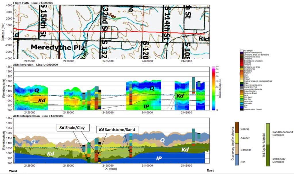
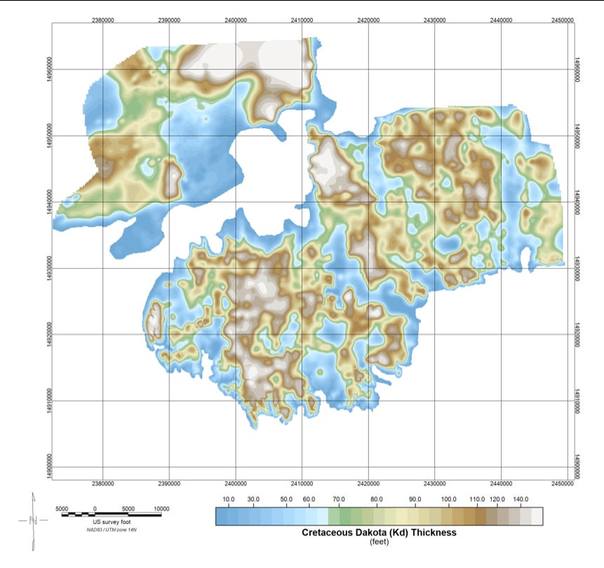
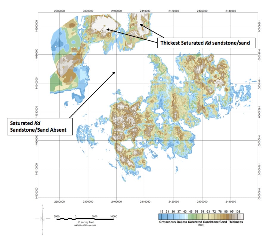
The Papio-Missouri River Natural Resources District flew a 1,020 line-kilometer AEM survey over eastern Nebraska in 2016 to map the hydrogeology and gain insights about the impact of recharge on water quality and drainage into the Platte River, a tributary of the Missouri River. AEM data is useful in determining the characteristics of the aquifers because of the electrical conductivity contrasts in the area.
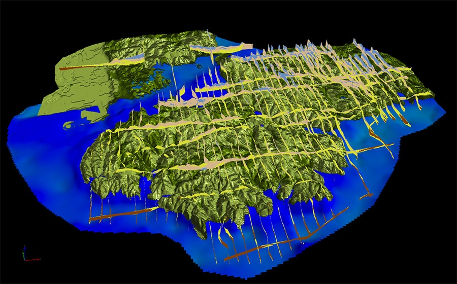
By integrating the data from each flight line with geologic mapping, previous AEM survey results and lithology, stratigraphy and geophysics from 1000 boreholes, consultant Jared Abraham of Aqua Geo Frameworks was able to classify the aquifers as either sandstone/sand dominant or shale/clay dominant and map the contact with overlying quaternary materials. He also determined the recharge potential based on resistivity measurements, derived from the AEM data, and topography.
The resulting 3D models will allow the district to update its understanding of the plumbing of the underground system and improve water quality by managing the nitrate source area and getting a better handle on the layout and function of the wells in the area.
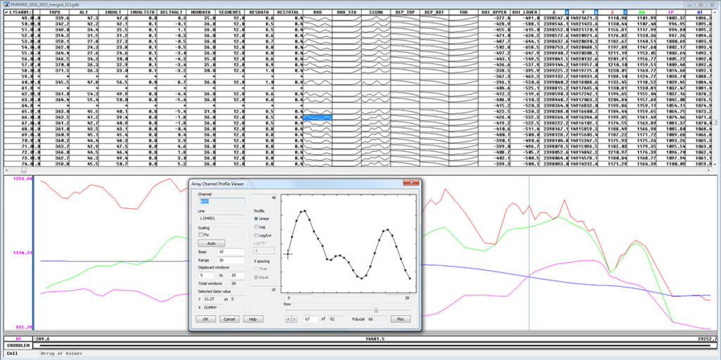
At the core of the interpretation are Geosoft borehole databases. They contain a variety of information, from stratigraphic logs documented by the Nebraska Conservation Survey Division (Nebraska Geological Survey) as far back as the 1930s to water discharge rates included in the state’s well registry.
The Geosoft database also includes the ability to display array channels, which Abraham uses to visualize and work with the AEM data.
Most of the historical data is in ASCII format that Abraham imports from CSV files using Geosoft’s built-in QA/QC checks to reject empty or duplicate files. “We use the borehole databases as our standard as we move them between different software packages (including ESRI, PA Discover, Google Earth and Aarhus Workbench),” he says.
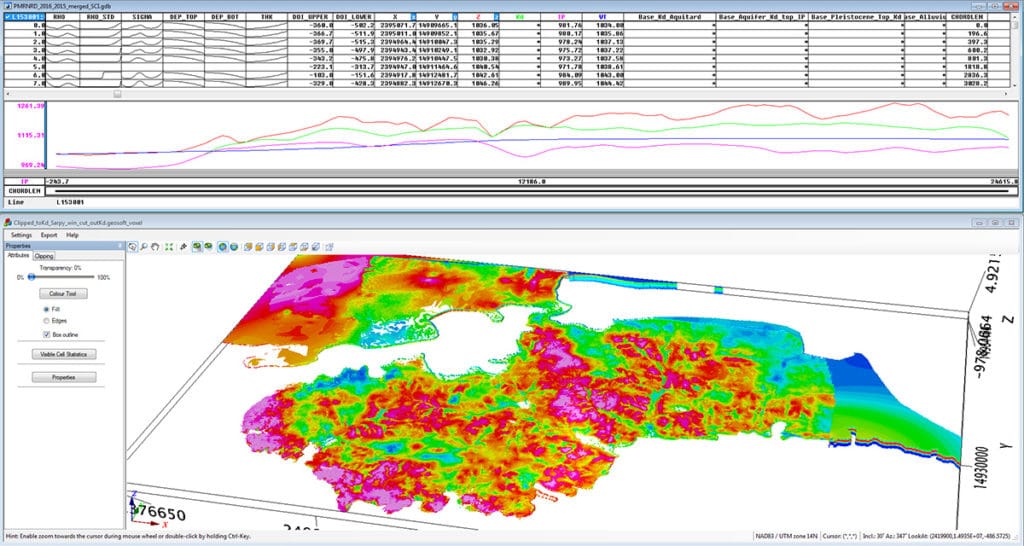
He then uses the databases to create voxel grids and 3D maps in Geosoft and extracts horizontal and vertical layers from the 3D voxel. Finally, he converts the data into a format (usually ESRI ArcGIS) his clients can use.
Abraham has conducted this type of hydrogeological study in other states and is just beginning a similar project in North Dakota. “Geosoft plays a critical role all through the project,” he says. “Even before we start integrating data, we do almost all of our QA/QC checks using Geosoft. Sometimes we’re on a non-linear path but the Geosoft databases are the keys we use as a standard throughout.”
More information on the project is available on the Eastern Nebraska Water Resources Assessment website.