Skip to main content
Sign In
MySeequent
MX Deposit
Imago
Bentley
English
Spanish
Portuguese (Brazil)
Russian
Close Search
Hit enter to search or ESC to close
Quick access to
Contact Us
All Products
Community
Software Downloads
Products
Geology
Leapfrog
3D geological modelling
Leapfrog Geo
For mining projects
Leapfrog Works
For civil & environmental projects
Leapfrog Energy
For energy projects
Target
Early stage exploration solution
Target
Drillhole visualisation and analysis
Target for ArcGIS Pro
Integrated with ArcGIS Pro
Seequent Central
Geological model management
Imago
Geological imagery collection & management
MX Deposit
Drillhole & sample data management
Volsung
Geothermal reservoir simulation
Geotechnical
OpenGround
Geotechnical data management
Leapfrog Works
3D geological modelling for civil & environmental
PLAXIS
Geotechnical analysis
PLAXIS 2D
2D finite element analysis for soil & rock
PLAXIS 3D
3D finite element analysis for soil & rock
PLAXIS Monopile Designer
Offshore foundation design for monopiles
Learn more about our PLAXIS software
GeoStudio
Stability, groundwater & environmental analysis
GeoStudio 2D
2D geotechnical analysis for soil and rock
GeoStudio 3D
3D geotechnical analysis for soil and rock
GeoStudio Flow
Heat and mass transfer process simulation
Seequent Central
Geological model management
Learn more about our Geotechnical workflow
Geophysics
Oasis montaj
Comprehensive geophysics solution
Oasis montaj
Geophysical modelling and analysis
VOXI
Geophysical inversion
UXO Land and UX-Analyze
Onshore UXO target detection
UXO Marine
Offshore UXO target detection
GM-SYS
Gravity and magnetic modelling
Oasis montaj extensions
Specialised Oasis montaj extensions
Aarhus GeoSoftware (AGS)
EM and ERT/IP processing and inversion
AGS Workbench
Complete EM and ERT/IP workflow solution
AGS Res2DInv and Res3DInv
ERT/IP data processing and inversion
SPIA
TEM and DC/IPVES data processing and inversion
DAP Server
Publishing, distributing & discovering exploration data
Seequent Central
Geological model management
Geostatistics
Leapfrog
3D geological modelling
Leapfrog Edge Extension
Geostatistical solution for mining
Leapfrog Contaminants Extension
Geostatistical solution for civil & environmental
Data Management & Collaboration
Imago
Geological imagery collection & management
MX Deposit
Drillhole & sample data management
OpenGround
Geotechnical data management
Seequent Central
Geological model management
View All Products
Industry Solutions
Mining
Grade Control
Industrial Minerals
Tailings Storage Facilities
Learn more about our Mining solutions
Civil
Transportation Infrastructure
Tunnelling Infrastructure
Tailings Storage Facilities
Learn more about our Civil solutions
Energy
Geothermal Energy
Oil & Gas
Wind
CCUS
Learn more about our Energy solutions
Environmental Solutions
Groundwater Resource Management
Unexploded Ordnance
Contaminated Sites
Learn more about our Environmental solutions
Resources
Industry Insights
Research & Reports
Success Stories
Videos
Blog
Our Community
Events
Community Forum
Social Media
Students & Educators
Academic Program & Licences
Visible Geology
What is Implicit Modelling?
Support
Support by Product
Leapfrog Geo
Leapfrog Works
Oasis montaj
GeoStudio
View all product support
Getting Started
Getting Started Overview
Software Downloads
System Requirements
Supported Data/Formats
About Seequent ID
Training & Guides
Online Learning
Guides & Tutorials
Upcoming Training
Community
Community Forum
Support for Administrators
For IT Administrators
Subscriptions & Billing
Contact Support
Company
About Us
Our Story
Mission & Purpose
Offices
Seequent Evo
Careers
Careers with Seequent
Current Opportunities
Our Teams
Life at Seequent
Corporate
Management Team
Partners
News
Newsroom
Contact us
search
Products
Main Menu
Products
Geology
Main Menu
Geology
Leapfrog
3D geological modelling
Main Menu
Leapfrog <span class="subtext">3D geological modelling </span>
Leapfrog Geo
For mining projects
Leapfrog Works
For civil & environmental projects
Leapfrog Energy
For energy projects
Target
Early stage exploration solution
Main Menu
Target <span class="subtext">Early stage exploration solution </span>
Target
Drillhole visualisation and analysis
Target for ArcGIS Pro
Integrated with ArcGIS Pro
Seequent Central
Geological model management
Imago
Geological imagery collection & management
MX Deposit
Drillhole & sample data management
Volsung
Geothermal reservoir simulation
Geotechnical
Main Menu
Geotechnical
OpenGround
Geotechnical data management
Leapfrog Works
3D geological modelling for civil & environmental
PLAXIS
Geotechnical analysis
Main Menu
PLAXIS <span class="subtext">Geotechnical analysis </span>
PLAXIS 2D
2D finite element analysis for soil & rock
PLAXIS 3D
3D finite element analysis for soil & rock
PLAXIS Monopile Designer
Offshore foundation design for monopiles
Learn more about our PLAXIS software
GeoStudio
Stability, groundwater & environmental analysis
Main Menu
GeoStudio <span class="subtext">Stability, groundwater & environmental analysis </span>
GeoStudio 2D
2D geotechnical analysis for soil and rock
GeoStudio 3D
3D geotechnical analysis for soil and rock
GeoStudio Flow
Heat and mass transfer process simulation
Seequent Central
Geological model management
Learn more about our Geotechnical workflow
Geophysics
Main Menu
Geophysics
Oasis montaj
Comprehensive geophysics solution
Main Menu
Oasis montaj <span class="subtext">Comprehensive geophysics solution </span>
Oasis montaj
Geophysical modelling and analysis
VOXI
Geophysical inversion
UXO Land and UX-Analyze
Onshore UXO target detection
UXO Marine
Offshore UXO target detection
GM-SYS
Gravity and magnetic modelling
Oasis montaj extensions
Specialised Oasis montaj extensions
Aarhus GeoSoftware (AGS)
EM and ERT/IP processing and inversion
Main Menu
Aarhus GeoSoftware (AGS) <span class="subtext">EM and ERT/IP processing and inversion </span>
AGS Workbench
Complete EM and ERT/IP workflow solution
AGS Res2DInv and Res3DInv
ERT/IP data processing and inversion
SPIA
TEM and DC/IPVES data processing and inversion
DAP Server
Publishing, distributing & discovering exploration data
Seequent Central
Geological model management
Geostatistics
Main Menu
Geostatistics
Leapfrog
3D geological modelling
Main Menu
Leapfrog <span class="subtext">3D geological modelling </span>
Leapfrog Edge Extension
Geostatistical solution for mining
Leapfrog Contaminants Extension
Geostatistical solution for civil & environmental
Data Management & Collaboration
Main Menu
Data Management & Collaboration
Imago
Geological imagery collection & management
MX Deposit
Drillhole & sample data management
OpenGround
Geotechnical data management
Seequent Central
Geological model management
View All Products
Industry Solutions
Main Menu
Industry Solutions
Mining
Main Menu
Mining
Grade Control
Industrial Minerals
Tailings Storage Facilities
Learn more about our Mining solutions
Civil
Main Menu
Civil
Transportation Infrastructure
Tunnelling Infrastructure
Tailings Storage Facilities
Learn more about our Civil solutions
Energy
Main Menu
Energy
Geothermal Energy
Oil & Gas
Wind
CCUS
Learn more about our Energy solutions
Environmental Solutions
Main Menu
Environmental Solutions
Groundwater Resource Management
Unexploded Ordnance
Contaminated Sites
Learn more about our Environmental solutions
Resources
Main Menu
Resources
Industry Insights
Main Menu
Industry Insights
Research & Reports
Success Stories
Videos
Blog
Our Community
Main Menu
Our Community
Events
Community Forum
Social Media
Students & Educators
Main Menu
Students & Educators
Academic Program & Licences
Visible Geology
What is Implicit Modelling?
Support
Main Menu
Support
Support by Product
Main Menu
Support by Product
Leapfrog Geo
Leapfrog Works
Oasis montaj
GeoStudio
View all product support
Getting Started
Main Menu
Getting Started
Getting Started Overview
Software Downloads
System Requirements
Supported Data/Formats
About Seequent ID
Training & Guides
Main Menu
Training & Guides
Online Learning
Guides & Tutorials
Upcoming Training
Community
Main Menu
Community
Community Forum
Support for Administrators
Main Menu
Support for Administrators
For IT Administrators
Subscriptions & Billing
Contact Support
Company
Main Menu
Company
About Us
Main Menu
About Us
Our Story
Mission & Purpose
Offices
Seequent Evo
Careers
Main Menu
Careers
Careers with Seequent
Current Opportunities
Our Teams
Life at Seequent
Corporate
Main Menu
Corporate
Management Team
Partners
News
Main Menu
News
Newsroom
Contact us
Sign In
MySeequent
MX Deposit
Imago
English
Spanish
Portuguese (Brazil)
Russian
Get in Touch
Newsroom
Media and PR enquiries
External Communications Team
[email protected]
+64 2150 1036
Filter
News & Updates
News & Updates
Press Coverage
World Water Day: Using data-driven transparency as a tool for building consensus on water | Water Canada
News & Updates
Press Coverage
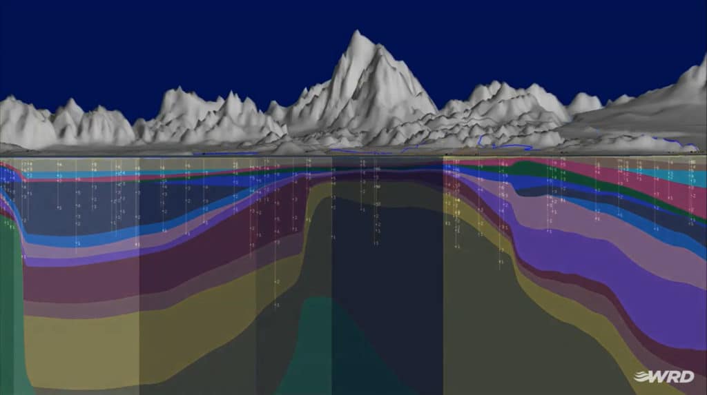
Revealing the fractured ice of Antarctica’s “Doomsday Glacier” | Geo Engineer
News & Updates
Press Coverage
This is THE Hidden Technology Champion Behind the Mining Industry (video) | Battery Commodity
News & Updates
Press Coverage
Technological solutions key to creating climate-resilient future | Engineering News
News & Updates
Press Coverage
Data-driven transparency as a tool for building consensus on water | smart water magazine
News & Updates
Press Coverage
Video: Seequent CEO on the future of subsurface construction | Construction Briefing
News & Updates
Press Coverage
Providing subsurface intelligence | The Globe and Mail
News & Updates
Press Announcement
PDAC 2024: Seequent Transforming Subsurface Understanding, Reshaping the Future of Mining
News & Updates
Press Coverage
PDAC 2024: Seequent Transforming Subsurface Understanding, Reshaping the Future of Mining | Newsfile
News & Updates
Press Coverage
How Geotechnical Engineering Software Transforms Infrastructure Projects (podcast) | Engineering Management Institute
News & Updates
Press Coverage
From drillhole to decision, faster | GeoDrilling International
Media Advisory
News & Updates
Indaba 2024: Seequent Transforming the Future of Mining in Africa with Subsurface Intelligence
News & Updates
Press Coverage
The Software That’s Making Mining Better for the Environment – Triple Pundit
News & Updates
Press Announcement
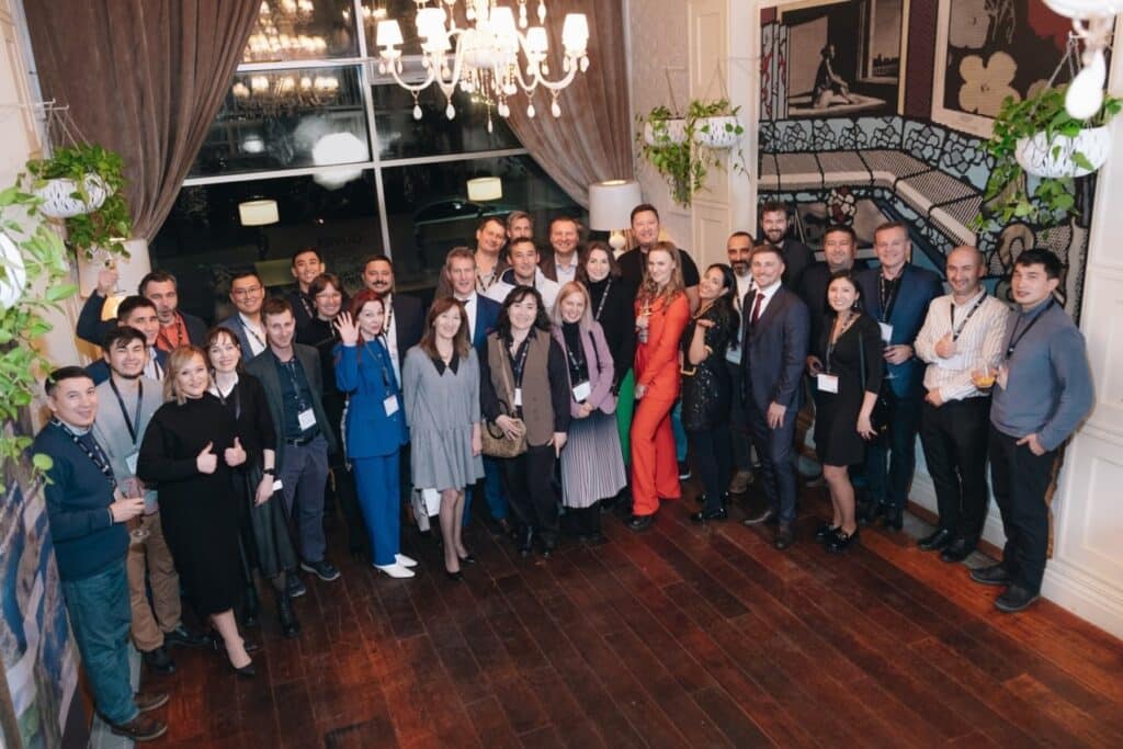
Seequent strengthens presence in Central Asia by establishing regional hub in Kazakhstan
News & Updates
News Alert
Seequent at COP28
News & Updates
Press Coverage
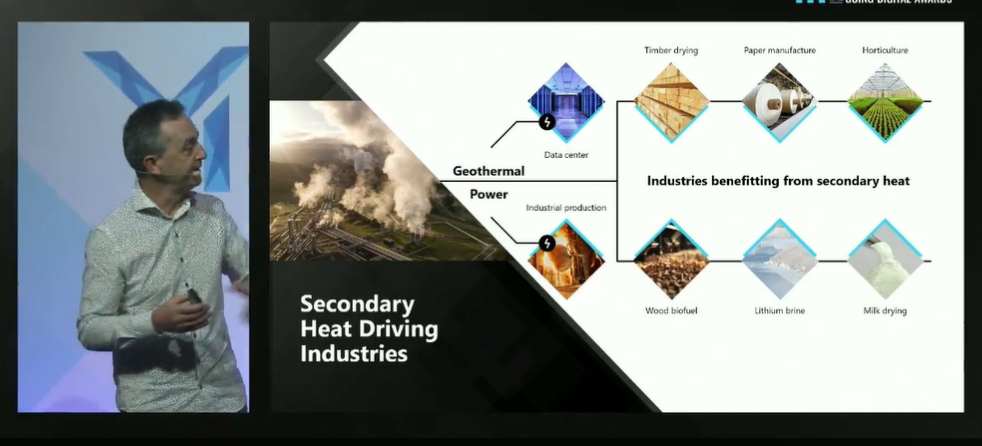
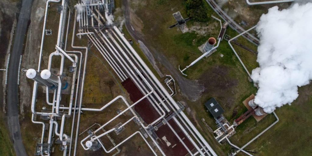
Building an industrial ecosystem on the back of geothermal energy | Power Engineering International
News & Updates
News Alert
Press Coverage
Innovation recognised in Mining Technology Excellence Awards
News & Updates
Press Announcement
Bentley Systems Announces Winners Of The 2023 Going Digital Awards In Infrastructure
Media Advisory
News & Updates
Press Announcement
Bentley Systems Announces Seequent’s Acquisition of Geothermal Simulation Leader Flow State Solutions
News & Updates
Press Announcement
Bentley Systems Announces The Finalists Of The 2023 Going Digital Awards In Infrastructure
News & Updates
Press Coverage
Mining industry still struggles to make data-driven decisions — report – Mining.com
Media Advisory
News & Updates
Meet the mines of the future: advanced robotics, autonomous vehicles, and AI-driven digital twins
News & Updates
News Alert
Civil infrastructure geoprofessionals are ready to adopt the cloud, new report says
News & Updates
News Alert
Mining industry sees data as vital but still struggles to make data-driven decisions
News & Updates
Press Coverage
The Christchurch tech company taking on the geological world | Q+A 2023
News & Updates
Press Coverage
Seequent introduces Leapfrog Energy for subsurface mapping – Carbon Capture Journal
News & Updates
Press Coverage
Geotechnical software: Closing the ground data gap – Ground Engineering
News & Updates
Press Coverage
Seequent expands subsurface capabilities with Leapfrog Energy – Think GeoEnergy
News & Updates
News Alert
Powering the energy transition: Seequent introduces Leapfrog Energy
News & Updates
Press Coverage
How Seequent remains relevant amidst an evolving geothermal industry – Think GeoEnergy
News & Updates
Press Coverage
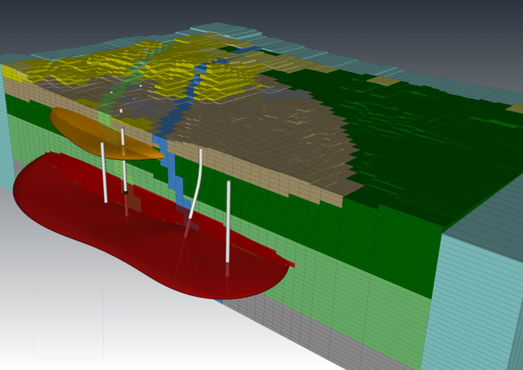
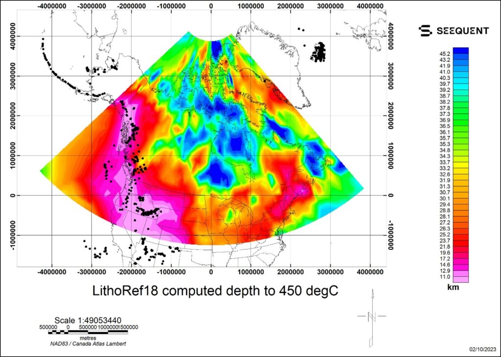
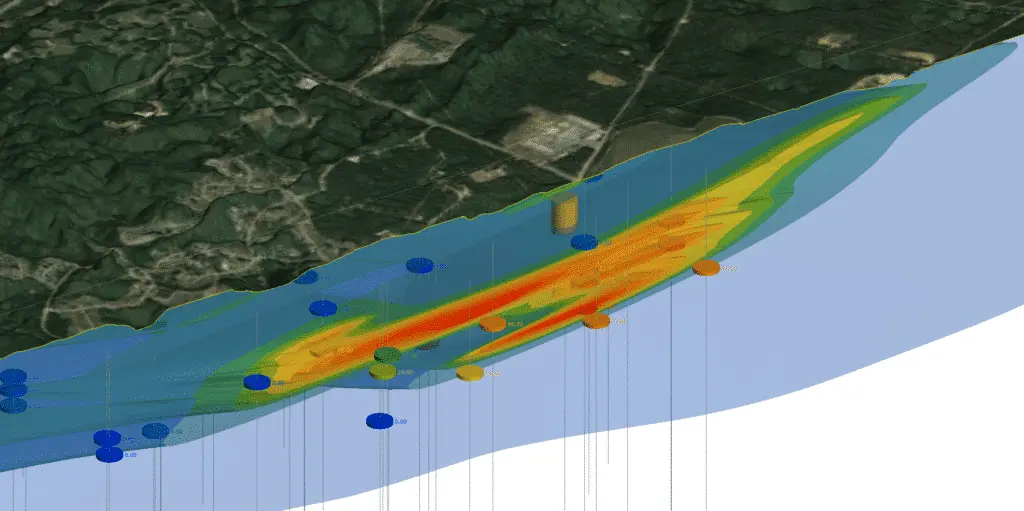
Mapping the 450 °C isotherm and the potential of deep geothermal in Canada – Think GeoEnergy
Media Advisory
News & Updates
GEOCONVENTION 2023: Seequent presentation on deep geothermal in Canada
News & Updates
Press Coverage
Seequent director Pat McLarin on the importance of subsurface digital twins – New Civil Engineer
News & Updates
News Alert
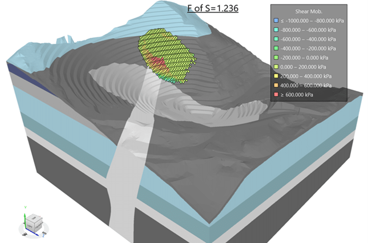
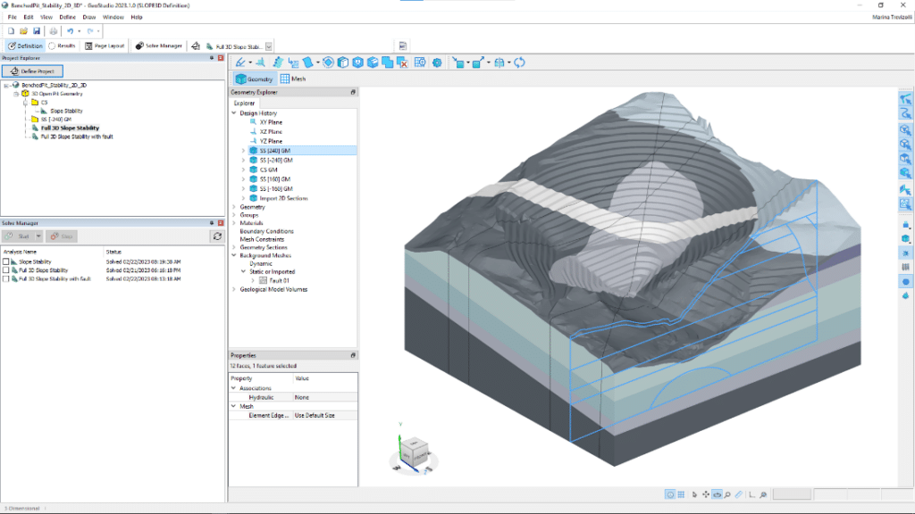
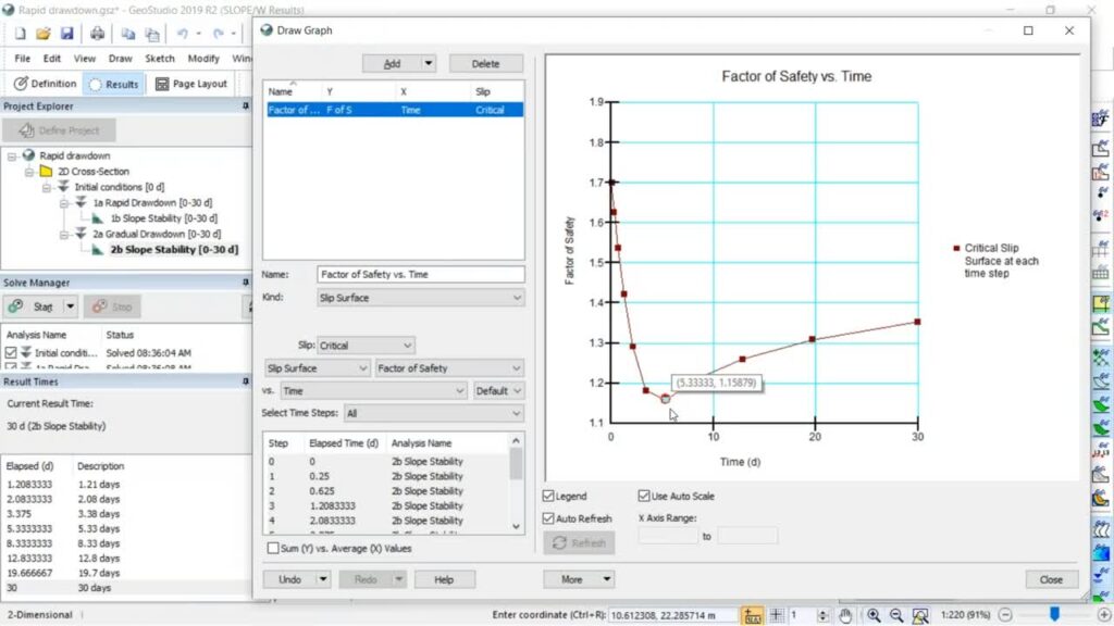
Seequent unveils SLOPE3D: Advanced stability analysis tool to help engineers design safer slopes
News & Updates
Press Coverage
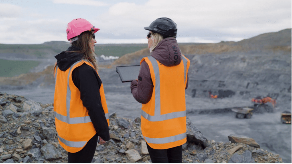
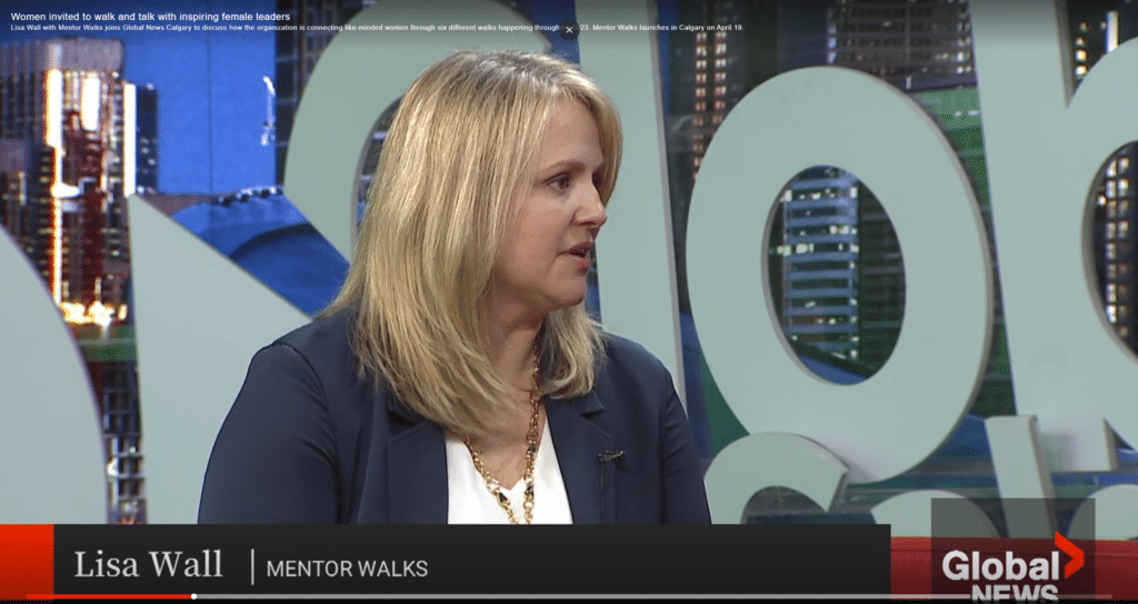
Women invited to walk and talk with inspiring female leaders – Global News
News & Updates
Press Coverage
Revolutionising mineral exploration through cloud-based collaboration – Mining Weekly
Civil
Civil Success
News & Updates
Revolutionising Geotechnical Engineering: Seequent and Bentley Joined Forces
News & Updates
PLAXIS
PLAXIS Enables Streamlined Infrastructure Projects with Leapfrog Interoperability
News & Updates
Press Announcement
Mentor Walks is launching its successful women-led mentoring program in Canada in April.
News & Updates
Press Coverage
Unlocking the power of data to drive sustainability in the mining sector | Sub-Sahara Mining & Industrial Journal
News & Updates
Press Coverage
Data and technology vital in sustainable mining – Mining Review Africa
News & Updates
Press Coverage
Drilling into digital – GeoDrilling International
Media Advisory
News & Updates
PDAC 2023: Seequent to showcase the power of subsurface software in exploration, celebrates ten years of Leapfrog Geo
Mining
News & Updates
Press Announcement
Seequent acquires DRIVER, an innovative solution for 3D analysis of geochemical data for insights and anomaly detection
News & Updates
PLAXIS
Products & Solutions
PLAXIS and OpenGround join Seequent, The Bentley Subsurface Company’s portfolio of geotechnical solutions
News & Updates
Press Announcement
Seequent named NZ HiTech Company of the Year 2022
Environmental
News & Updates
Oasis montaj
UXO
UXO Marine
Whats new
More accessible and precise target modelling with the latest release of UXO Marine and Oasis montaj 2022.1
AGS
Case Studies
Mining Success
News & Updates
Workbench unlocks the value of IP effects in TEM data to enhance mining models
News & Updates
Press Announcement
Seequent named Supreme Award winner at 2021 AmCham Awards
News & Updates
Press Announcement
International Society for Soil Mechanics and Geotechnical Engineering honours PLAXIS innovation
News & Updates
Mentor Walks to give women access to female leaders in Christchurch
News & Updates
Seequent named a finalist in 2022 NZ Hi-Tech Awards
News & Updates
Press Announcement
Seequent named Best Established Business in Prestigious Export Awards
News & Updates
Channel Partner Program
Industry Insights
Mining
News & Updates
Seequent Evo
Artificial Intelligence has great potential, but it’s only human…
News & Updates
Press Announcement
A win for Seequent in NZ’s Westpac Champion Business Awards 2021
News & Updates
Press Announcement
Bentley Systems Announces Seequent’s Acquisition of Advanced Resources and Risk Technology (AR2Tech)
News & Updates
Seequent highlights the critical role of ESG in industrial minerals mining recruitment efforts
News & Updates
Seequent launches insight paper on the future of sustainability in mining
News & Updates
Press Announcement
Seequent hosts Lyceum 2021 connecting thousands in geoscience community for more resilient and sustainable future
News & Updates
Bentley Systems Announces Seequent’s Acquisition of Minalytix
News & Updates
Press Announcement
Seequent to host geoscience community at 6th annual Lyceum virtual events
News & Updates
Press Announcement
Bentley Systems Announces Seequent’s Acquisition of Imago
AGS
News & Updates
Press Announcement
Bentley Systems Announces Seequent’s Acquisition of Aarhus GeoSoftware
News & Updates
Press Announcement
Bentley Systems Acquires Seequent Ltd
News & Updates
Press Announcement
Seequent appoints new CEO
News & Updates
Press Announcement
Finalist in the 2021 New Zealand Hi-Tech Awards
News & Updates
Press Announcement
Bentley Systems Enters into $1.05 Billion Agreement to Acquire Seequent, Global Leader in 3D Modeling Software for the Geosciences
News & Updates
Press Announcement
Seequent unveils major updates for its digital twin toolkit for mining
News & Updates
Press Announcement
Seequent introduces next-generation digital twin technologies for infrastructure and environmental projects
News & Updates
Press Announcement
Seequent named a tech company to watch for impressive global growth
News & Updates
Press Announcement
Seequent expands into South Korean infrastructure market with BasisSoft software reseller agreement
News & Updates
Seequent shares vision for the future at virtual conference Lyceum 2020
News & Updates
Sustainability
Seequent and Microsoft partner in global water sustainability commitments
Lyceum
News & Updates
Seequent to host virtual geoscience technology conference – Lyceum 2020, September 23
News & Updates
Seequent reinvents geotechnical analysis with new GeoStudio Core
News & Updates
Press Announcement
Seequent accelerates cloud solutions to help keep world at work on major projects
Civil
GeoStudio
News & Updates
Videos
Rapid Drawdown Analysis with SLOPE/W and SEEP/W
Contaminants extension
News & Updates
Press Announcement
Sustainability
Seequent launches contaminated site solution to aid environmental sustainability
News & Updates
COVID-19 We are here to help
News & Updates
Seequent announces new leadership appointments for growth
News & Updates
An update on COVID-19 from our CEO, Shaun Maloney
News & Updates
Seequent Wins 2020 Esri Partner Award
News & Updates
UN Mine Workshop
Mining
News & Updates
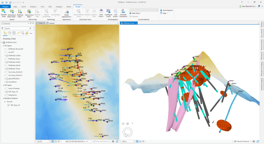
Target for ArcGIS Pro
Target for ArcGIS Pro enhances integration of mining and exploration data
Culture
Events
News & Updates
Sustainability
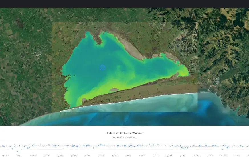
Satellite-based lake health monitoring system an aerospace winner
Community
Culture
News & Updates
Press Announcement
Seequent Women in Geothermal Visibility Scholarship Winner 2019
GeoStudio
News & Updates
Press Announcement
Seequent expands with GEOSLOPE’s geotechnical analysis software GeoStudio
News & Updates
Partners
Press Announcement
Seequent continues investment in innovation for world’s major resource challenges with Minalytix partnership
Leapfrog Works
News & Updates
Press Announcement
Jacobs signs major agreement to use Seequent’s solutions on Civil & Environmental projects
News & Updates
Press Announcement
Seequent and Murray & Co Win M&A Transaction of the Year
News & Updates
Press Announcement
Seequent delivers major release for mining solutions
News & Updates
Press Announcement
Seequent Completes Acquisition of Geosoft Creating Unparalleled Geological Modelling and Geoscience Software Offering
Culture
News & Updates
Strength Through Diversity: Meet the Women in Geothermal
News & Updates
Press Announcement
Seequent Acquires Geosoft to Create Subsurface Geoscience and Modelling Powerhouse
News & Updates
Press Announcement
Seequent Named Supreme Winner at 2018 New Zealand International Business Awards
News & Updates
Seequent Opens US office in Colorado
News & Updates
Seequent opens US office; appoints key Civil & Environmental talent to support infrastructure projects
Leapfrog Geo
News & Updates
Partners
Seequent Central
Seequent and IMDEX to Deliver Real-Time 3D Visualisation for Minerals Drilling Projects